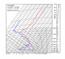
| Whenuapai | Paraparaumu | Invercargill |
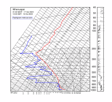 | 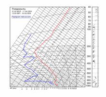 | 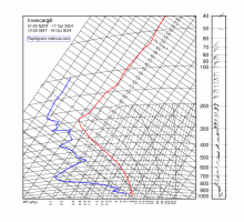 |
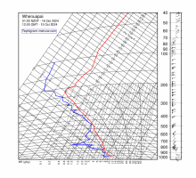
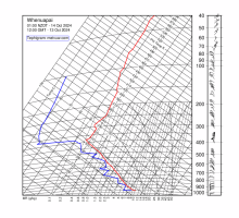
| 0100 NZDT Thu 17 Oct 2024 | 0100 NZDT Thu 17 Oct 2024 | 0100 NZDT Thu 17 Oct 2024 |
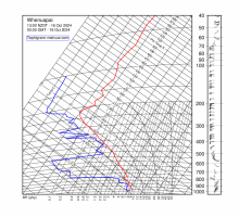 |  |  | | 1300 NZDT Wed 16 Oct 2024 | 1300 NZDT Wed 16 Oct 2024 | 1300 NZDT Wed 16 Oct 2024 |
 |  |  | | 0100 NZDT Wed 16 Oct 2024 | 0100 NZDT Wed 16 Oct 2024 | 0100 NZDT Wed 16 Oct 2024 |
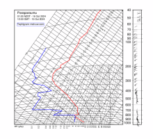
 |  |  | | 1300 NZDT Tue 15 Oct 2024 | 1300 NZDT Tue 15 Oct 2024 | 1300 NZDT Tue 15 Oct 2024 |
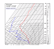 | 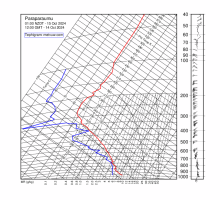 | 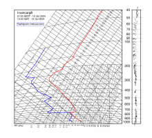 | | 0100 NZDT Tue 15 Oct 2024 | 0100 NZDT Tue 15 Oct 2024 | 0100 NZDT Tue 15 Oct 2024 |
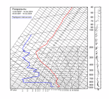
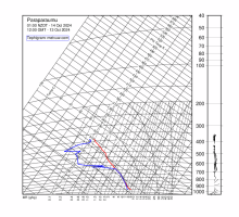
 |  |  | | 1300 NZDT Mon 14 Oct 2024 | 1300 NZDT Mon 14 Oct 2024 | 1300 NZDT Mon 14 Oct 2024 |
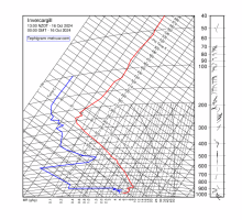
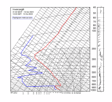
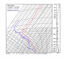
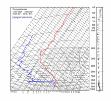
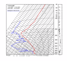
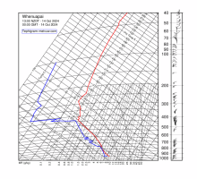
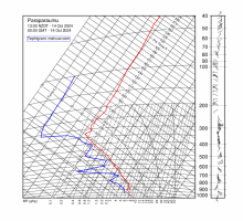
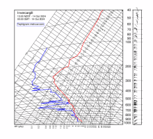
 |  |  | | 0100 NZDT Mon 14 Oct 2024 | 0100 NZDT Mon 14 Oct 2024 | 0100 NZDT Mon 14 Oct 2024 |

